Recent Changes in Shelfbreak Exchange on the Northeast Shelf: Process-Oriented Observations of Salinity Maximum Intrusions

GENERAL DESCRIPTION:

Photo taken from: https://www.uri.edu/news/2019/04/join-uri-students-on-r-v-endeavor-oceanographic-research-expedition-earth-day-april-22/.Photo courtesy of the Inner Space Center.
Observations from a number of sources including the OOI Pioneer Array, the Ecosystem Monitoring surveys of the National Marine Fisheries Service, and the Commercial Fisheries Research Foundation/WHOI Shelf Research Fleet have shown Warm Core Ring water masses have been transported across the continental shelf much further onshore in recent years.
It is proposed to study one particular process, the pycnocline salinity maximum, in which shelf and ring water may be transported tens of kilometers shoreward. This process has been identified for decades but to date, there has not been three-dimensional hydrographic mapping of these features nor have there been turbulence measurements within these features. It is proposed to use a combination of analysis of existing historical hydrographic data from the three sources mentioned above with process-oriented research cruises in 2021 and 2022 (TBD due to COVID-19 health and safety restrictions). Mapping will occur using two REMUS 100 Autonomous Underwater Vehicles along with shipboard CTD and VMP profiling. The May/June time period is when rings are most likely to be present adjacent to the continental shelf, and this is also when squid make seasonal movements onshore across the continental shelf.
This project ended in November 2024. Check out the project results section for the final report and final results brochure.
PROJECT Goals:

REMUS 100 Autonomous Underwater Vehicle. Photo by Tom Kleindinst, WHOI
Map mid-depth salinity maximum intrusions- establish along shelf scales and vertical positions/thickness via Autonomous Underwater Vehicles (AUVs)
Follow intrusion for up to 1 week in pilot cruise and up to 2 weeks in main experiment with AUVs
Measure turbulence and mixing characteristics of salinity maximum intrusion
Determine the nature of organisms riding onshore in intrusion (acoustics, and net tows)
PROJECT TEAM:
Wood Hole Oceanographic Institution
Glen Gawarkiewicz
Frank Bahr
Ruth Musgrave
Amy Kukulya
Svenja Ryan
Andone Lavery
School for Marine Sciences and Technology
Avijit Gangopadhyay
Adrienne Silver
Commercial Fisheries Research Foundation
Susan Inglis - CFRF Project Lead
N. David Bethoney
Noelle Olsen
National Marine Fisheries Service
Anna Mercer
Paula Fratantoni
Michael Jech
Project results:
Final Report:
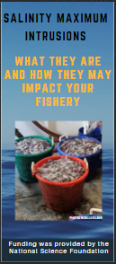
Final Results Brochure:
Check out this brochure for final project results!
Project Outreach:
Industry Meeting:
In November 2023 we hosted a meeting with commercial sea scallop fishermen about ocean conditions. Click on the icon on the right to watch the video of the meeting!

Salinity Maximum Intrusion Storybook:
Sarah Ring, who interned at CFRF in 2022, produced this interactive storymap about how fishermen’s at-sea observations help fill in data gaps for the Salinity Maximum Intrusions project.
Publications
“Integrating fishers’ knowledge with oceanographic observations to understand changing ocean conditions in the Northeast United States” by Noelle A. Olsen, Frank Bahr, N. David Bethoney, Anna M. Mercer, and Glen Gawarkiewicz. 2023. Frontiers in Marine Science 10. https://doi.org/10.3389/fmars.2023.1144178
“Increasing Frequency of Mid-Depth Salinity Maximum Intrusions in the Middle Atlantic Bight” by G. Gawarkiewicz, P. Fratantoni, F. Bahr, and A. Ellertson. 2022, Journal of Geophysical Research Oceans, Vol. 127.